Total length1.3 million m
17.4 millionBaseball diameters
5.9 millionTV remotes
42,933Blue whale lengths
The world's least useful encyclopedia
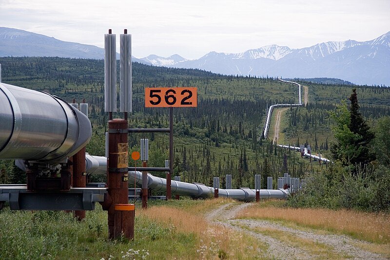
Photo by Luca Galuzzi, Wikimedia Commons (CC BY-SA 2.5)
An 800-mile oil artery crossing tundra, mountains, and permafrost/Infrastructure
The Trans-Alaska Pipeline System (TAPS) stretches 1,288 kilometers from Prudhoe Bay on the Arctic coast to the port of Valdez on Prince William Sound. Completed in 1977 at a cost of roughly $8 billion (about $40 billion adjusted for inflation), the pipeline was one of the largest private construction projects in history. It crosses three mountain ranges, over 800 rivers and streams, and vast stretches of permafrost. About half of the pipeline is elevated on vertical support members with heat pipes to prevent the warm oil from melting the permafrost beneath. The pipe itself has an outer diameter of 1.22 meters (48 inches). At peak capacity, it moved roughly 2 million barrels per day, though throughput has declined significantly since the 1980s.
About 3 years, 1974 to 1977