Approximate area3.1 trillion m2
4.3 trillionBath towels
295 billionTrampoline surfaces
3.1 million km2, varies with currents
The world's least useful encyclopedia
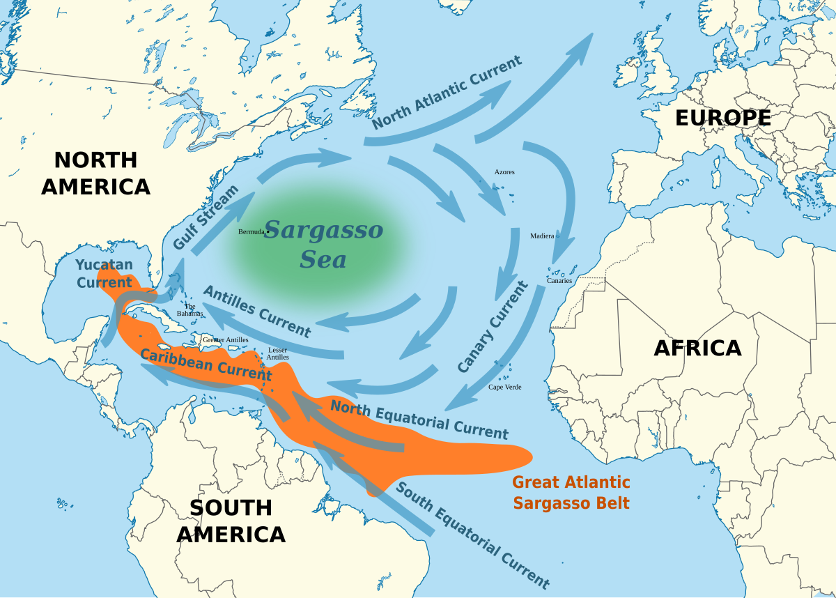
Photo from Wikimedia Commons
The only sea defined by ocean currents rather than coastlines/Oceans & Seas
The Sargasso Sea is unique among Earth's seas: it has no land boundaries, instead being defined by four ocean currents that form the North Atlantic subtropical gyre. Covering about 3.1 million square kilometers in the western North Atlantic, it is named for the floating Sargassum seaweed that accumulates on its surface. The sea is remarkably clear (visibility up to 60 m) and calm, and serves as the spawning ground for both European and American eels, which make epic migrations to breed here. The Bermuda Triangle overlaps its western edge.
3.1 million km2, varies with currents
Approximate width
Approximate height
Deep open ocean
Exceptionally clear water
About 24 degrees C