Approximate length (pole to pole)20 million m
18.7 millionHurdle heights
55,260Cruise ship lengths
13.3 billionAnt antennae
The world's least useful encyclopedia
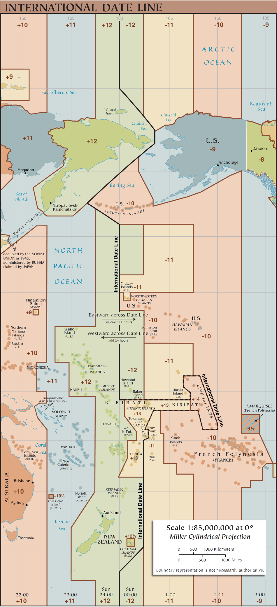
Photo from Wikimedia Commons
The imaginary line where today becomes tomorrow/Infrastructure
The International Date Line (IDL) is an imaginary line running roughly along the 180th meridian in the Pacific Ocean, where the calendar date changes by one day. Traveling westward across the line advances the date by one day; traveling eastward sets it back. While conceptually straight, the actual line zigzags to avoid splitting countries and island groups into different dates. It was established by international agreement in 1884 at the International Meridian Conference in Washington, D.C. The line passes through no major landmass, traversing mostly open ocean from the Arctic to the Antarctic.
24 hours / 1 calendar day
Established 1884